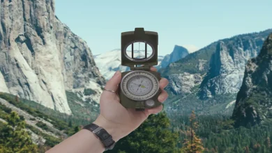
There’s a particular kind of quiet that settles over you when you realize you don’t know where you are. Not the pleasant disorientation of a new city with a phone in your pocket, but the older, more primal version standing in the middle of a forest, the trail behind you looking exactly like the trail ahead, the light doing nothing useful. Your compass is back in the car. Your phone died an hour ago. And the sun, if you can even find it through the canopy, is somewhere in that general direction you keep calling “over there.”
This is the moment most people discover they know almost nothing about reading the natural world. Which is a strange gap, when you think about it. Humans navigated by stars, shadows, and moss for tens of thousands of years before the first GPS satellite went up. That knowledge didn’t disappear it just got buried under the assumption that we’d never need it again.
You might need it again. Here’s what actually works.
The Sun Is a Clock, Not Just a Light Source
Most people know the sun rises in the east and sets in the west. Fewer people know how to turn that fact into something actionable when they’re standing in a clearing at two in the afternoon wondering which direction leads back to the trailhead.
The shadow-stick method is old enough that it predates written history, and it still holds up. Find a straight stick about a foot long and push it into the ground in a spot with direct sunlight. Mark the tip of the shadow with a small rock or a scratch in the dirt. Wait fifteen to twenty minutes longer is better then mark where the shadow tip has moved. Draw an imaginary line between your first mark and your second. That line runs roughly west to east, with the first mark pointing west and the second pointing east. Stand with your left foot on the first mark and your right on the second, and you’re facing approximately north.
The reason this works is elegant in its simplicity. The sun moves across the sky from east to west, which means shadows move in the opposite direction. You’re not tracking the sun you’re tracking its inverse, which is easier to pin down precisely because it’s right there on the ground.
One caveat worth knowing: the closer you are to the equator, the less reliable this becomes, because the sun passes more directly overhead and the shadow movement gets compressed. In temperate latitudes most of the continental United States, Europe, the northern half of Asia it’s remarkably accurate.
What the Stars Have Been Telling Us for Millennia
If you’re navigating at night, the sky gives you something the daytime rarely offers: a fixed point. Polaris, the North Star, sits almost directly above Earth’s geographic north pole. It doesn’t rise or set the way other stars do. It just stays there, within about one degree of true north, while everything else wheels around it.
Finding Polaris takes about thirty seconds once you know the trick. Locate the Big Dipper that distinctive ladle shape that most people can identify even with minimal astronomy knowledge. Focus on the two stars that form the outer edge of the dipper’s “cup,” the side farthest from the handle. Those two stars are called the pointer stars, and they do exactly what the name suggests. Draw an imaginary line through them and extend it outward about five times the distance between them. That’s Polaris. It’s not the brightest star in the sky, which surprises most people it’s actually fairly modest in appearance. But it’s the one that doesn’t move.
On a clear night, this gives you a north bearing accurate enough to maintain consistent direction through several hours of hiking. The challenge is cloud cover, which is also the reason experienced wilderness travelers learn multiple methods rather than relying on any single one.
Reading the Landscape: What Trees and Terrain Actually Tell You
The moss-on-the-north-side-of-trees idea has been repeated so many times it’s almost become folklore, which has unfortunately made people skeptical of it. The skepticism isn’t entirely wrong moss grows wherever moisture accumulates, and moisture patterns depend on local topography, wind patterns, and the specific ecosystem you’re in. In a dense Pacific Northwest forest, you might find moss blanketing every surface regardless of direction. In that context, moss tells you almost nothing.
But in drier climates, particularly in North America’s interior west and across much of Europe, the principle holds with enough consistency to be useful. In the northern hemisphere, the south-facing sides of trees and rocks receive more direct sunlight, which dries them out faster. Moss, which needs moisture to thrive, tends to colonize the north-facing sides where shade lingers longer. The key is to check multiple trees and look for a pattern rather than trusting any single specimen.
Snow melt offers a similar logic. On a hillside, south-facing slopes lose their snow cover faster because they catch more direct sun. If you’re in late winter or early spring terrain, patches of lingering snow on one side of a ridge and bare ground on the other can give you a rough directional read without any other reference points.
Tree rings, if you happen to be near a freshly cut stump, tell a version of the same story. Rings tend to be slightly wider on the south side of a tree, where growing conditions are more favorable. It’s subtle, and you need a reasonably clean cross-section to read it, but it’s there.
The Wind and Weather Patterns Beneath Your Feet
Prevailing winds are one of the most underused navigational references available to anyone willing to study the local patterns before heading out. In most of the continental United States, prevailing winds blow from the west or southwest. This means that over time, the landscape itself gets shaped by wind and those shapes can be read.
Trees in exposed areas often develop a characteristic lean or asymmetrical branch growth in response to consistent wind direction, a phenomenon sometimes called wind flagging. The branches grow more densely on the sheltered side, and the whole tree can take on a swept appearance that points like an arrow in the direction the wind habitually comes from. If you know prevailing winds run west to east in your region, a tree leaning persistently to the east tells you something.
Sand dunes work on the same principle. The windward side of a dune the side the wind hits tends to be gentler in slope, while the leeward side is steeper. In desert navigation, experienced travelers read dune morphology the same way a sailor reads wave patterns.
None of this is precise in the way a compass is precise. A compass gives you a bearing to the nearest degree. Natural navigation gives you something more like a strong probability, a directional tendency, a hypothesis you can test against other observations. The real skill isn’t mastering any single method it’s learning to triangulate between several of them simultaneously, the way your great-great-grandparents would have done without thinking twice about it.
There’s something almost meditative about that process once you start practicing it. You stop moving through the landscape and start reading it. The light, the growth patterns, the way the snow sits on one hillside longer than another these stop being background noise and start being a kind of language. One you were always capable of learning. You just never had a reason to before.